Newland Research Articles
Location
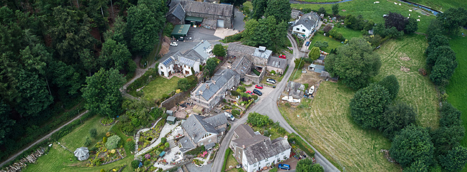
Newland is a beautiful valley area shaped roughly like a a triangle, with the A590 running through the base, Mansriggs is at the top, Arrad Foot to the east, Ulverston to the west and Plumpton to the south. In the top of the triangle is a steep hanging valley known as Newland Bottom. Originally the land was used for farming but the fast flowing Newland Beck attracted business entrepreneurs to create various mills.
Research Articles
There are a number of excellent documents that explain the history and current status. Click to learn more.
| Title of Article | Content |
|---|---|
| W&F Conservation Areas | Appraisal. Maps |
| The Story of Newland Furnace | Restoration. Newland Furnace Trust. |
| The Wider Influence of the Newland Company | Interactions between Industries and Key People |
Contributions from Residents
| Building(s) | Content |
|---|---|
| Newland Bottom | Precis of a booklet produced about the history of the mill and associated buildings |
| Newland Corn Mill | Story of the renovation from derelict remains to residence |
Photo Gallery
We have a range of historical and current photographs in the Photo Gallery. They are grouped into albums according to the source of the Photograph. Navigate to locate an album using the navigation menu at the top of the page, or click on specific links for the Newland galleries below.
| Title of Album | Purpose |
|---|---|
| Mike Davies-Shiel Collection Newland | Photos of Historic Industrial Buildings |
| Residents Collection Newland | Personal photos; Illustrations and Maps |
| David Kyles Collection Newland | Photos of landscapes and buildings |
Maps
There are a number of maps showing various aspects of the Newland area. Click on Maps and Links and scroll down to find the map you would like to view.